

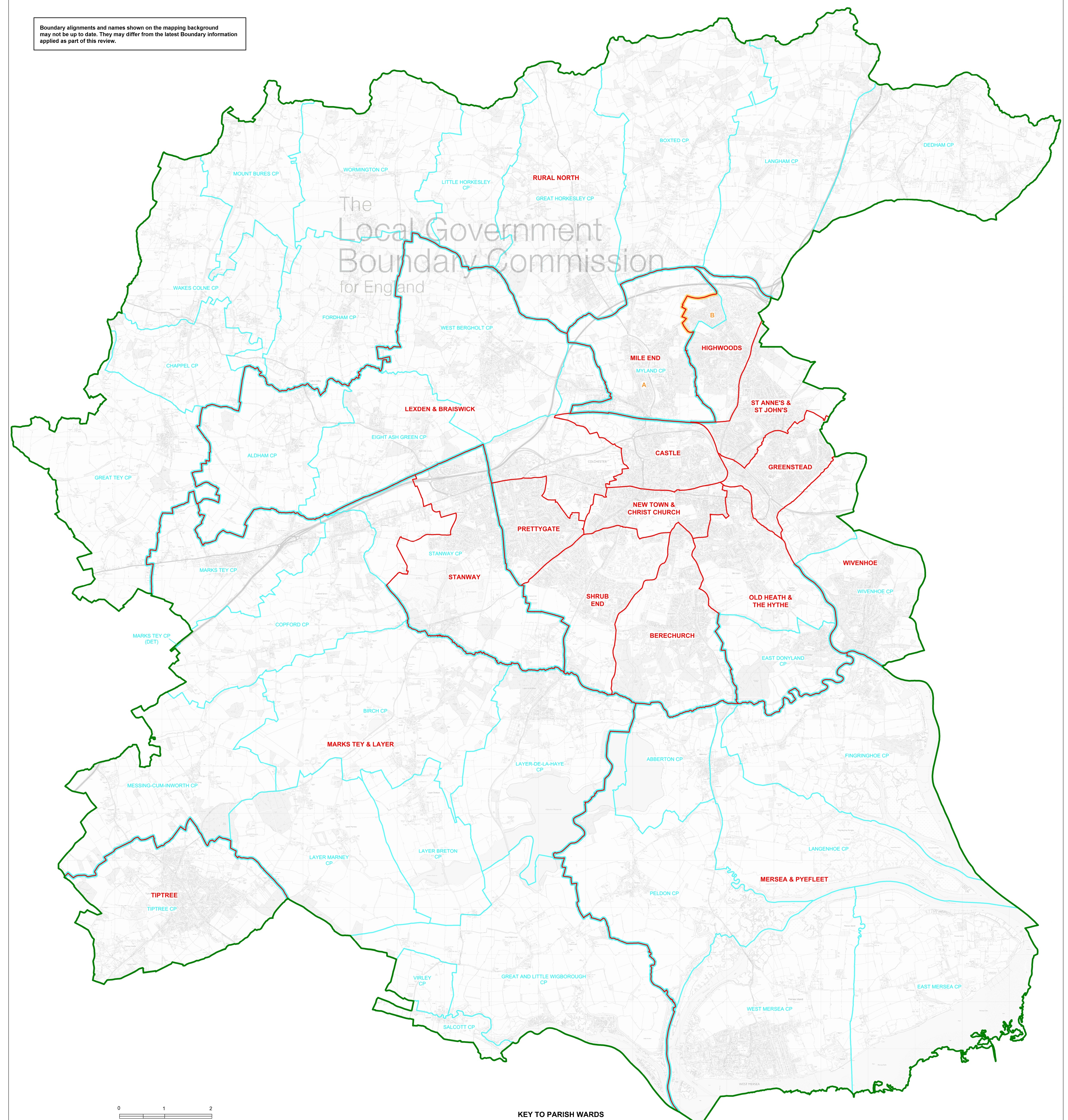
Colchester ward and parish boundaries
Map referred to in the Colchester (Electoral Changes) Order 2015
This map is based upon Ordnance Survey material with the permission of Ordnance Survey on behalf of the Controller of Her Majesty's Stationery Office - Crown copyright.Unauthorised reproduction infringes Crown copyright and may lead to prosecution or civil proceedings.
The Local Goverment Boundary Commission for England GD10049926 2015.
Boundary alignments and names shown on the mapping background may not be up to date. They may differ fom the latest Boundary information applied as part of this review.
KEY:
Green line - city Council Boundary
Red line - Ward Boundary
Light blue line - Parish Boundary
Light blue boardered red line - Ward Boundary coincident with Parish Boundary
Yellow boarded red line - Ward Boundary coincident with Parish Ward Boundary
RED TEXT - Ward name
LIGHT BLUE TEXT - Parish name
Page last reviewed: